
by Alana Coulombe, Education programs administrator
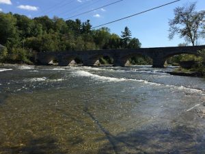
Naturally occurring freshwater lakes, rivers, and streams are connected through a dynamic network. Freshwater lakes are typically immobile bodies of water surrounded by land on all sides. Rivers consist of currents that flow down a channel and connect to larger water bodies. Like rivers, streams contain flowing water and often merge forming larger streams and rivers. An ordering framework classifies the streams within watersheds such that a stream at the highest elevation is a first-order stream that becomes a second-order stream when joined by another first-order stream (Agriculture and Agri-Food Canada [AAFC], 2020). Shortening the length of shorelines and simplifying their structure in map view by straightening channels and removing irregularities and side channels impacts the ecology of the shore zone by reducing habitat diversity, eliminating backwater areas, and decreasing the land-water interface area (Strayer & Findlay, 2010). Studies of reduced shoreline complexity and biodiversity show dramatic changes in large rivers and similar but smaller changes along lake shorelines (Strayer & Findlay, 2010).
Changes in size, depth, flow, gradient, light penetration, and substrate characteristics along a river or stream influence local conditions (McCabe, 2011). These physical variations alter the habitat and food sources available within the river or stream, creating a diverse range of potential niches for aquatic organisms (McCabe, 2011). As a result, the distributions of invertebrates, fish, and algae are very dynamic and shift in response to high-water events and biological interactions (McCabe, 2011). Moreover, the value of shorelines as passageways for the movement of wildlife and organic matter depends on their orientation, length, water movement, and cover availability (Strayer & Findlay, 2010). For example, major rivers offer longer and more linear shorelines as dispersal corridors compared to small, closed lakes (Strayer & Findlay, 2010). Since rivers and streams exchange resources with the surrounding environment, the water quality, aquatic organisms, and sediment characteristics reflect the localized area as well as the upstream and downstream conditions (McCabe, 2011).
 Larger river systems involving lakes typically have less harsh flow regimes and greater flow regularity than small systems as lakes provide base flow and lessen the impacts of extreme snowmelt and precipitation events (Jones et al., 2014). Small, harsh streams are less stable, and thus support smaller organisms that mature quickly, are generalists, tolerate variable habitats, and have overabundant reproductive cells in each cycle (Jones et al., 2014). Conversely, large rivers with lake outlets provide more stable and predictable habitats that support larger organisms with later maturity, more specialized habits, greater competitive ability, and fewer reproductive cells per cycle (Jones et al., 2014). Additionally, invertebrate abundance and species richness are influenced by the size and roughness of substrates, and thus respond differently to different combinations of water depth and velocity (McCabe, 2011). Therefore, the physical characteristics and flow regimes of water bodies influence species populations and biological communities (Jones et al., 2014).
A watershed is an area of land that catches rain and snowmelt and allows it to seep into the ground as groundwater or drain through a network of streams and rivers into larger bodies of water such as lakes and oceans (AAFC, 2020). Everything is connected in a watershed as small streams join to form larger tributaries that merge into even larger rivers (World Wildlife Fund Canada [WWF-Canada], 2020). Therefore, watersheds are dynamic, nested systems meaning smaller watersheds nest into larger ones (AAFC, 2020). The underlying sediment or bedrock and structural features, like fractures and faults, influence the drainage patterns in a watershed (AAFC, 2020). Characteristics of watersheds include the shape, slope arrangement, total area, overall elevation change, drainage network, land-use patterns, geology, soils, and vegetation cover (AAFC, 2020). Did you know Canada has 25 major watersheds separated by the height of the land, and is made up of over 100 smaller sub-watersheds (WWF-Canada, 2020)?
WWF-Canada assesses watershed health based on four indicators representing important elements of aquatic ecosystems. Firstly, hydrology looks at natural flow patterns and water volume changes in a river over time. The dynamic littoral (shoreline) zones of rivers with large, predictable water-level fluctuations contribute to the ecosystems’ high biodiversity and productivity (Strayer & Findlay, 2010). Secondly, water quality concerns the levels of chemical pollutants in the river, including phosphorus, heavy metals, and chloride, which can affect aquatic life, recreational activities, and drinking water. Thirdly, the number and diversity of benthic invertebrates, such as beetles, snails, and leeches, living at the bottom of the river are sensitive to ecological disturbance and are vital for the aquatic food chain. Lastly, maintaining native fish populations is important because fish play key roles in aquatic food chains, the overall biodiversity in a river, and providing food and recreational opportunities for humans.
According to WWF-Canada (2020), the health of Canada’s freshwater is threatened by invasive species, pollution, habitat loss and fragmentation, climate change, overuse of water, and water flow alterations due to human-made structures like dams and reservoirs. Human activities like urban development affect lower orders of rivers and streams which impacts the larger watershed. You can learn more about the overall health of and specific threats to different sub-watersheds by visiting WWF-Canada’s Watershed Reports.
Rivers are very important for floodplains, adjacent low-lying areas of land that are subject to flooding. The severity and frequency of floods will increase significantly over time due to climate change impacts, urban developments, and poor flood control measures (Mohanty & Simonovic, 2021). Additionally, pollution, farming and urban development on floodplains, and river flow disruptions have reduced aquatic ecosystems’ resilience to extreme flood events which will likely exacerbate water quality issues in these watersheds (Talbot et al., 2018). Changes in floodplain regimes are expected with significant rises in flood inundation extents, particularly intense over northern and western Canada (Mohanty & Simonovic, 2021). Additionally, flood hazards may cover almost 16% more geographical area of Canada and large areas in northern and western Canada and a few eastern parts may face more frequent floods (Mohanty & Simonovic, 2021). Flood protection strategies to protect ecosystem services include restoring river-floodplain connectivity, reconnecting fragmented aquatic ecosystems, and regenerating riparian zones (Talbot et al., 2018).
References
Agriculture and Agri-Food Canada. (2020). Understanding watersheds. Government of Canada. https://agriculture.canada.ca/en/agriculture-and-environment/agriculture-and-water/watershed-protection/understanding-watersheds#a5
Jones, N. E., Schmidt, B. J., & Melles, S. J. (2014). Characteristics and distribution of natural flow regimes in Canada: A habitat template approach. Canadian Journal of Fisheries and Aquatic Sciences, 71(11), 1616–1624. https://doi.org/https://doi.org/10.1139/cjfas-2014-0040
McCabe, D. J. (2011). Rivers and streams: Life in flowing water. Nature Education Knowledge, 3(10):19. https://www.nature.com/scitable/knowledge/library/rivers-and-streams-life-in-flowing-water-23587918/
Mohanty, M. P., & Simonovic, S. P. (2021). Changes in floodplain regimes over Canada due to climate change impacts: Observations from CMIP6 models. Science of The Total Environment, 792(Complete). https://doi.org/https://doi.org/10.1016/j.scitotenv.2021.148323
Strayer, D. L., & Findlay, S. E. G. (2010). Ecology of freshwater shore zones. Aquatic Sciences, 72, 127–163. https://doi.org/10.1007/s00027-010-0128-9
Talbot, C. J., Bennett, E. M., Cassell, K., Hanes, D. M., Minor, E. C., Paerl, H., Raymond, P. A., Vargas, R., Vidon, P. G., Wollheim, W., & Xenopoulos, M. A. (2018). The impact of flooding on aquatic ecosystem services. Biogeochemistry, 141, 439–461. https://doi.org/https://doi.org/10.1007/s10533-018-0449-7
World Wildlife Fund Canada. (2020). Watershed reports. https://watershedreports.wwf.ca/page/indicators/#intro
This blog is part of a five-part series generously funded under the Great Lakes Protection Initiative – Areas of Concern (AOC) Program by Environment and Climate Change Canada. This three-year project will support important shoreline restoration in the St. Lawrence River AOC through the Natural Edge Program, and is being delivered by Watersheds Canada, Mohawk Council of Akwesasne, River Institute, Great River Network, and Raisin Region Conservation Authority.