
Publications
A Green Guide to Cottage Care
In this resource, you will find over twenty practical ways to maintain your cottage, all while taking care of the environment. From septic care to minimizing light pollution, these tips were handpicked to help you benefit from our 20 years of knowledge on watersheds and protecting our waterways. Download
A Regulatory Guide to Achieving Environmental Net Gain at the Waterfront

Currently, very few municipalities mention Environmental Net Gain in their existing policies around waterfront development proposals. This package outlines what an Environmental Net Gain is and why they are a critical consideration when protecting waterfront health. Coming soon!
All About My Lake: A Self-Assessment Exercise
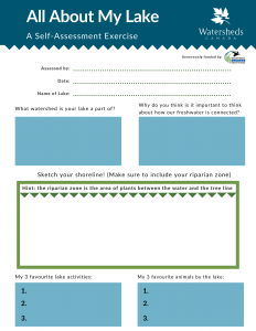
Developed for the “Ontario Shoreline and Freshwater Health: Multimedia Experience” project generously funded by Wildlife Habitat Canada, this handout will help you and your family connect to your local water body, learn about the local species that live there, and take action to solve local problems you may be seeing on your lake. Lake Evaluation Card PDF
BioBlitz Protocols
![]()
This manual will provide guidance and suggestions to best maximize the efficiency and value of these community science events through proper data collection and data sharing. The resources provided include species checklists, data entry forms, registration forms, information for landowners, and media and communications documents. As each BioBlitz is unique in its purpose, goals, challenges, and limitations, the advice and resources used during each event will be dependent on the organizers and participants.
Assistance for this project was provided by the following: Project Steering Committee: Jeff Ward, Community Stewardship Council of Lanark County; Barbara King, Watersheds Canada; Karen Hunt, Otty Lake Association; James Pagé, Ontario Ministry of Natural Resources; Stew Hamill David Crossman, Ontario Ministry of Natural Resources; Claire Lefrancois, the Friends of the Mac Johnson Wildlife Area; Partner Groups: Community Stewardship Council of Lanark County; Watersheds Canada; Ontario Ministry of Natural Resources; YMCA/YWCA Youth Eco Internship Program; Otty Lake Association. A guide for Planning Community BioBlitz Events in Eastern Ontario PDF
Citizen (Community) Science Programs in Ontario
Developed for the 2019 Lake Links workshop, this handout outlines general identification and monitoring programs, and species identification and monitoring programs for animals, insects, birds, invasive species, water quality, and weather. This handout was compiled by Holly Evans from Cataraqui Conservation. Handout – Citizen (Community) Science Programs in Ontario PDF
Fish Habitat Enhancement Protocols

Before starting your own project you may want to consult our step by step protocol on In-Water Brush Piles, available here: In-water Structures – Brush Protocols. It includes everything you will need to know, from planning and developing the project through to carrying it out successfully.
These protocols were prepared by Lanark County Stewardship Council and Watersheds Canada, and was possible because of generous funding from the Government of Canada, Ontario Trillium Foundation, Cabela’s Canada Outdoor Fund, and LUSH Cosmetics.

Before starting your own project you may want to consult our step by step protocol on Walleye Spawning Bed Enhancement in Ontario, available here: Walleye Spawning – Bed Enhancement. It includes everything you will need to know, from planning and developing the project through to carrying it out successfully.
These protocols were prepared by Lanark County Stewardship Council and Watersheds Canada, and was possible because of generous funding from the Government of Canada, Ontario Trillium Foundation, Cabela’s Canada Outdoor Fund, and LUSH Cosmetics.

Before starting your own project you may want to consult our step by step protocol on Cold-water Creek Enhancement in Ontario, available here: Cold-water creek enhancement. It includes everything you will need to know, from planning and developing the project through to carrying it out successfully.
These protocols were prepared by Lanark County Stewardship Council and Watersheds Canada, and was possible because of generous funding from the Government of Canada, Ontario Trillium Foundation, Cabela’s Canada Outdoor Fund, and LUSH Cosmetics.
Guide to Building Resilient Shorelines: Mitigating the Impacts of Climate Change

This manual is intended for landowners wanting to increase the resiliency of their shoreline in light of increased impacts of climate change. This manual outlines several actions that you can take to help create resilient shorelines capable of adapting to changing conditions, and was possible because of generous funding from RBC Tech for Nature. Download
Guide to Preparing a Shoreline Naturalization Planting Plan
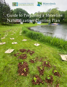
This comprehensive and step-by-step planting plan template will assist you in assessing your property’s site conditions and clearly demonstrate ways vegetation will be increased as a result of your plan. The planting plan is divided into four parts: Draw your Planting Area, Assess Planting Area Conditions, Choose Plants, and Maintenance Plan. Get started now!
How to Engage Community in a Lake Plan

The process of developing a lake stewardship plan relies on full involvement and participation of the community on and around the lake. The process is community-driven, and the resulting plan is a community plan. Recounting the experience of conducting a lake plan for Mississippi Lake can offer useful insights into how to best engage people in such a process. This project was based on the Mississippi Lake Planning Project funded by the Ontario Trillium Foundation. How to Engage Community in a Lake Plan PDF
Lake Protection Workbook: A Self-Assessment Tool for Shoreline Property Owners
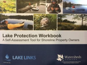
Check out our “Lake Protection Workbook: A Self-Assessment Tool for Shoreline Property Owners”. Diagnose any shoreline property problems, and see how you can help your shoreline. You can download an online copy for free, or order a physical copy for $2.00+shipping. Printing funded by Watersheds Canada and the Daniel and Susan Gottlieb Foundation.
This Workbook was produced by the Lake Links Planning Committee with collaboration and review from: Cataraqui Region Conservation Authority, Friends of the Tay Watershed Association, Lake Networking Group, Lanark County Stewardship Council, Mississippi Valley Conservation Authority, Ontario Ministry of Natural Resources and Forestry, Rideau Valley Conservation Authority, and Watersheds Canada.
Light Pollution Handout

Developed at the 2008 Lake Links workshop, this handout outlines solutions to light pollution, including an activity for children to build a simple shield for outdoor lights using outdoor paint and cardboard. Light Pollution handout PDF
Native Plant Care Guide

This manual is intended for landowners participating in the Natural Edge Shoreline Naturalization Program. Naturalizing your shoreline is a great way to improve and protect your waterfront property. Naturalizing shorelines is a process which takes some time and care and plant loss is a normal occurrence in nature. This Guide will help you maximize your plant survival rate by providing you with information on how to maintain and care for your new plants – Restoring the Ribbon of Life! This guide was possible because of generous funding from the Government of Canada. Download
Resilient Shorelands infographic
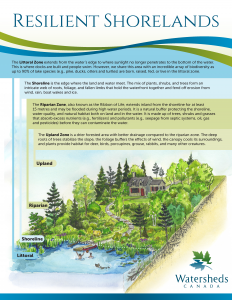
Did you know a shoreland is made up of many different zones? Learn more about what a shoreland is, who lives there, and how a natural shoreland is most resilient to impacts from climate change in this infographic. Download
Shoreline Habitat Creation Manual
This manual is intended for landowners wanting to enhance their properties, or create habitat which is essential for fish and wildlife species. This manual was possible because of generous funding from the Ontario Trillium Foundation and the Government of Canada. Download
“The Future of Our Shores” report
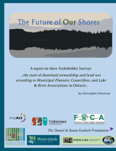
This report reflects the findings from three stakeholder surveys on the state of shoreland stewardship and land-use according to municipal planners, councillors, and lake and river associations in Ontario. Read here
The Science Behind Vegetated Shoreland Buffers: Why the Ribbon of Life Matters
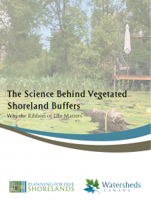
Using highly-cited and peer-reviewed scientific studies, this document outlines the benefits of vegetated shoreland buffers, and discusses why local decision makers, landowners, developers, and landscape professionals should maintain or restore native vegetation to achieve holistic protection for waterfront properties and ecosystems. Download
Wildflower Garden Guide (Ontario)

This guide will help landowners create their very own native wildflower gardens which will benefit our local pollinator species: bees, butterflies and hummingbirds. This guide was possible because of generous funding from the Daniel and Susan Gottlieb Foundation. Download
Wildflower Garden Guide (Saskatchewan-specific)
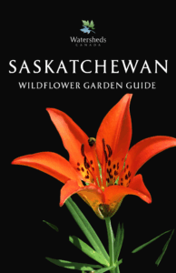
This guide will help landowners create their very own native wildflower gardens which will benefit our local pollinator species: bees, butterflies and hummingbirds. Download
Freshwater Stewardship Engagement Toolkit

The Freshwater Stewardship Engagement Toolkit is a compilation of resources that can help you complete greening projects in your community! It covers a wide variety of topics, such as Community Gardens, Community Science, Fish Habitat, Green Audits and Retrofits, Indigenous Water Education, Invasive Species Management, Natural Shorelines, Shoreline Cleanups, and Youth Engagement. Read the Online Toolkit!
This toolkit was created as a part of the Ottawa Faith Community Capacity Building Program. Watersheds Canada and Greening Sacred Spaces launched this program to provide faith communities in Ottawa and the surrounding area with the tools to identify a freshwater stewardship need in their community. Thank you to the Ottawa Community Foundation and TD Friends of the Environment Foundation for making this important project possible!
Fact Sheets

Critical Habitat Features
This handout outlines eight action steps shoreline property owners can take to create and enhance critical habitat features for local fish and wildlife. These features will help local populations as you create a wildlife-friendly shoreline: Critical Habitat Features for Fish and Wildlife
 What is a Watershed?

A watershed is an area of land that catches rain and snow, and allows it to drain into a stream, river, lake or seep into the ground as groundwater.
Learn more: What is a Watershed?
 The Benthic Zone
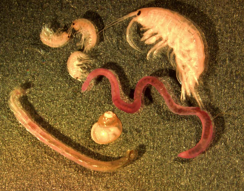
Interested in the life within the substrate? Read our Fact Sheet: The Benthic Zone Photo Source: Macrobenthics, January 2016, Wikipedia the free encyclopedia, https://en.wikipedia.org/wiki/Benthos
 The Riparian Zone

Known as the “Ribbon of Life”, the riparian zone is an area between the upland zone and the shoreline. Learn more from our Fact Sheet: The Riparian Zone